

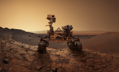
NASA’s Curiosity rover has successfully ascended a sharply sloped Martian cliff to study a proposed erosional supersurface, an important break in Mars’ geologic timeline that may hold clues to past environmental shifts. According to NASA, the rover approached and climbed onto the Cerro Paine Grande vertical exposure, enhancing its ability to analyze this feature during its recent mission activities.
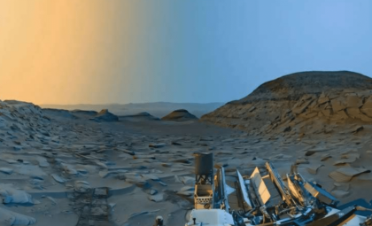
After climbing, Curiosity was positioned at about a 24-degree incline, nearing its record tilt angle of 27 degrees for conducting contact science. From this elevated stance, the rover captured a full 360-degree panoramic view while its suite of instruments examined sediment layers stratified above and below the hypothesized boundary. The goal is to determine whether these rock formations document eras marked by dominance of wind, water, or both forces.
Identifying a Significant Break in Mars’ Rock Layers
The geologic formation under study has been labeled by NASA researchers as a potential “erosional supersurface.” Such surfaces signal a shift from sediment deposition to erosion, and then back to deposition, creating an interruption in the sedimentary record.

These distinctions are crucial because sedimentary strata often archive evidence of environmental transformations occurring before they were exposed on the surface of Mars. Layers just below and above this erosional surface might display varying textures and structures, granting scientists the ability to piece together the planet’s ancient environmental history.
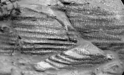
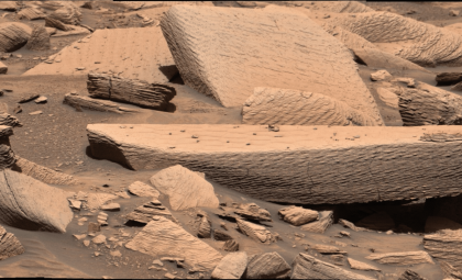
Curiosity has already encountered rock textures that might shed light on these past conditions. NASA teams have observed formations resembling aeolian structures, which are shaped by wind-driven activity, alongside “lens”-shaped deposits potentially indicative of fluvial processes. These latter features may reveal sediments moved or deposited by flowing water.
Current investigations aim to move beyond visual impressions by capturing higher resolution imagery and conducting chemical analyses to better distinguish the origins of these rock features.

Curiosity’s Ascent to Cerro Paine Grande
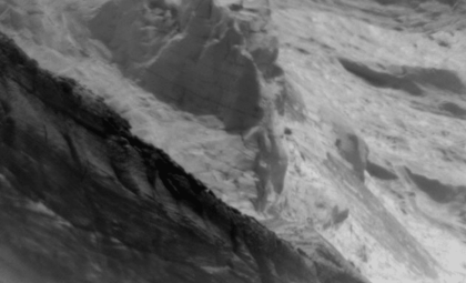
In its most recent trek, Curiosity got close enough to the Cerro Paine Grande vertical cliff to perform detailed analyses just below the candidate supersurface. The rover then scaled the feature, creating a fresh observational platform for both visual and physical examination of the outcrop.
This climb demonstrated Curiosity’s capability to operate on challenging, steep slopes. It ended the maneuver at roughly a 24-degree tilt, while mission planners ensured the rover was well positioned for precise contact science activities. NASA noted this effort nearly matched the mission’s previous record tilt of 27 degrees for such operations.
Once steadied on the incline, Curiosity utilized its Mastcam to record expansive stereo mosaics of the cliff face and later produced a 360-degree panoramic image from this vantage point.
These visual datasets offer more than picturesque scenery; stereo images assist scientists in mapping the three-dimensional formation of the rock layers, while panoramic views contextualize individual structures within the broader geological landscape. Such perspectives help determine how these layers correspond to the suspected erosional break.

Detailed Analysis of the Rocks Around the Boundary
The imaging work was complemented by close-range measurements from various instruments. The Mars Hand Lens Imager (MAHLI) documented detailed textures, while the Alpha Particle X-ray Spectrometer (APXS) analyzed elemental compositions. Additionally, ChemCam’s laser-induced breakdown spectroscopy (LIBS) was employed to remotely assess rock chemistry.
During the Sol 4968 planning session, scientists targeted a light-colored bedrock patch named Puyehue for planned observations using APXS, MAHLI, and ChemCam LIBS. Two more LIBS targets were selected nearby: Lago Palena, a similar light-toned block, and Piedras Juntas, a layered rock of particular interest situated at the edge of the work area.
Scientists also gathered an APXS measurement of sand at a location called Cormudesi. This data will aid in evaluating the uniformity of sand composition along Curiosity’s path.
These observations are significant because rocks that look alike aren’t always formed under the same conditions. Chemical differences can expose variations in sediment sources, alteration histories, or depositional settings that aren’t obvious from their exterior textures alone.
- Categories:
- Nasa







0 comments
Sign in to Comment