

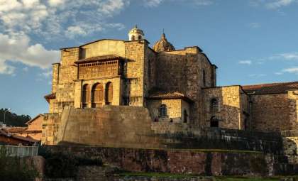
Researchers have uncovered and charted a vast system of Inca tunnels underneath Cusco. The main subterranean corridor extends roughly 1750 meters (about 1.1 miles) connecting the Temple of the Sun (Coricancha), once the religious heart of the Inca capital, to the Sacsayhuaman ruins.
Known as the “Chincana”, this tunnel network has been mentioned in historical documents for more than three centuries before scientific techniques like acoustic sensing and geophysical surveys pinpointed its underground path beneath present-day Cusco. Jorge Calero Flores and Mildred Fernandez Palomino have spearheaded research on the Chincana since 1998.
The system includes a primary tunnel stretching from Coricancha to Sacsayhuaman, accompanied by three smaller side tunnels. These secondary corridors extend toward Callispuquio, the Muyucmarca sector of Sacsayhuaman, and behind the Church of San Cristobal.

The main tunnel runs north to south through central Cusco for roughly 1.75 kilometers, aligning with parts of the ancient Inca roadway and terraces on the surface. This measurement was shared in the team’s latest findings.

The corridor’s dimensions are estimated at approximately 260cm (8.5ft) wide and 160cm (5.2ft) tall. Calero suggests these measurements could have allowed people to be carried through the tunnel on litters.
“It’s possible that the Incas traversed these passages using litters,” Calero explained.
While the dimensions support physical movement through the tunnel, the exact purpose of this passage within Inca society remains speculative. The team has not offered conclusive interpretations of its function.
Historical Texts Guided the Investigation
Written records played a crucial role in guiding the team’s search for the Chincana, rather than beginning with excavation. A 1594 account from an unknown Jesuit mentions an underground path between Coricancha and Sacsayhuaman. Colonial documents referencing subterranean routes in Cusco were also analyzed.
By comparing descriptions dating back to the 1500s–1700s with current views of Cusco’s topography, the team identified likely access points, concentrating their search in the Rodadero area near Sacsayhuaman.
Researchers then employed acoustic surveying methods to detect voids beneath the surface. Following this, ground-penetrating radar (GPR) technology was used to gather detailed data on underground features.

GPR works by sending electromagnetic pulses into the ground and detecting changes in the reflected signals caused by material differences. This data was translated into three-dimensional visualizations of hidden structures.
Combined acoustic and radar survey results allowed the researchers to chart a tunnel route beneath Cusco without continuous invasive digging along the entire stretch between Coricancha and Sacsayhuaman.
Building Techniques Behind the Chincana
Investigations indicate that the tunnel system was constructed using a cut-and-cover approach.
According to the team, the Incas excavated trenches, erected stone walls along their sides, built wooden beam roofs, then covered the structure. Above these tunnels, roadways, streets, and terrace systems were established.
The route’s layout correlates with this construction method. Some sections are beneath the main Inca thoroughfare that once linked Sacsayhuaman with Coricancha, while other parts lie under existing terraces.

The engineering style observed closely matches historical accounts cited in the study. For instance, Garcilaso de la Vega referenced subterranean vaults linking the towers of Sacsayhuaman.
Results were presented through radargrams, maps, and 3D models showcasing the position and shape of these underground formations.
Non-Invasive Surveying Precedes Active Excavation
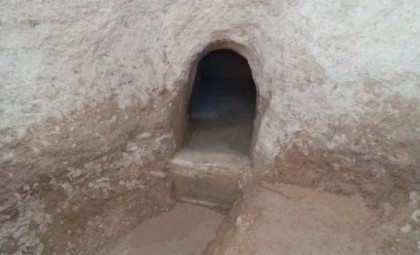
Although the underground network has been extensively mapped using remote sensing methods, direct exploration has not yet been undertaken. According to Fernandez, targeted digging at specific spots is needed to access the tunnel.
“Our next step involves strategic excavation to gain entry,” Fernandez noted.
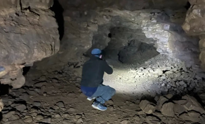
Following these excavations, detailed exploration of the subterranean passages will commence.
- Categories:
- Science


0 comments
Sign in to Comment