

A team of scientists has harnessed orbital data from about 1,200 Starlink satellites to reconstruct the density of the atmosphere nearly 500 kilometers above Earth’s surface. This novel approach offers fresh insights into the hard-to-monitor thermosphere and may enhance tracking capabilities amid increasingly congested orbital environments.
Low Earth orbit hosts thousands of satellites and space debris, where even minimal atmospheric drag can impact orbital dynamics. At altitudes of several hundred kilometers, such drag causes gradual orbital decay, making accurate atmospheric density measurements vital to forecasting satellite trajectories and preventing collisions.
Observing this layer is challenging because over 99% of the upper atmosphere consists of electrically neutral gases. In contrast, the ionosphere, made up of ionized gases under 1%, affects radio wave transmission and is easier to monitor. Capturing data on the neutral thermosphere, spanning roughly 100 to 1,000 kilometers above Earth, remains difficult.

Turning Starlink into an Atmospheric Research Asset
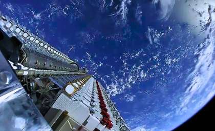
Scientists from Kyoto University tackled this challenge by utilizing satellites already present in the thermosphere. According to published data, the team analyzed publicly available orbital positions of nearly 1,200 Starlink satellites cruising at an altitude of about 482 kilometers. Their approach depends on observing how atmospheric drag causes slow orbital decay, from which they calculated the surrounding thermospheric density.

The team employed tomography, a technique widely used in medical diagnostics, to synthesize global observations into a detailed depiction of local atmospheric density variations.
“This is a multidisciplinary study between space science and space engineering,” corresponding author Mamoru Yamamoto said. “Reading papers from both research fields, we realized that deeper dialogue between researchers from both fields is necessary.”
Geographic Thermosphere Map Offers New Insights
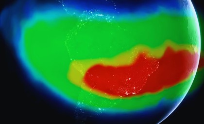
Utilizing the Starlink data, researchers created a two-dimensional latitude-longitude map illustrating atmospheric density near 500 kilometers altitude. This is the first time tomography has been applied to atmospheric measurements at this scale. Their results matched closely with density observations from the ESA’s SWARM satellites, which collect atmospheric data along their orbits.
Building on their prior work using Two-Line Element (TLE) data to track thermospheric density changes over time and altitude, this map adds valuable horizontal detail to atmospheric modeling by revealing geographic density variations across latitude and longitude.

By extending their analysis horizontally, the scientists were able to uncover spatial patterns in the thermosphere that were previously undetectable in their earlier vertical-only studies.
Why Understanding Atmospheric Density Is Crucial for Satellites
Neutral atmospheric particles even at extreme altitudes produce enough drag to influence satellite motion, making precise atmospheric density estimates critical for predicting satellite orbits.
The study highlights how improved density data can enhance orbital path forecasts, supporting collision avoidance strategies as the volume of orbiting bodies rises.

This research bridges atmospheric science and space engineering by providing new insights into an otherwise elusive section of Earth's upper atmosphere, while delivering practical data to satellite operators.
The technique could ultimately facilitate near-real-time monitoring of atmospheric density around satellites, improving space weather prediction and boosting the safety and reliability of satellite missions.
- Categories:
- Science








0 comments
Sign in to Comment