

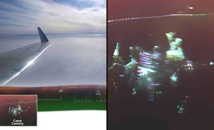
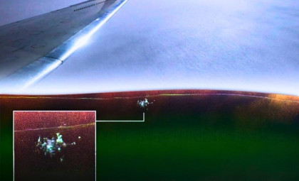
During a routine radar instrument test over northern Greenland in April 2024, researchers captured the most detailed radar image to date of Camp Century, an old U.S. military installation that has remained encased beneath over 30 meters of ice since its closure in 1967.
Onboard a Gulfstream III, NASA scientist Chad Greene and his engineering team were flying about 150 miles east of Pituffik Space Base when unexpected radar signals appeared beneath the surface. Their original aim was to calibrate the instrument, not to discover hidden infrastructure.
“We were scanning for the ice base, then suddenly Camp Century showed up,” explained Alex Gardner, a cryosphere expert at NASA’s Jet Propulsion Laboratory (JPL) who co-led the project. “At first, we weren’t sure what the radar signal indicated.”

Cold War Tunnels Dug Within Greenland’s Ice
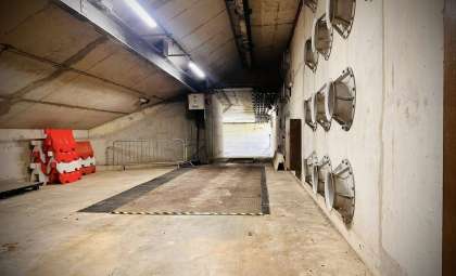
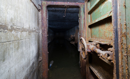
Constructed in 1959 by the U.S. Army Corps of Engineers, Camp Century consists of a 3-kilometer network of 21 tunnels carved just below the surface layer of the northwestern Greenland Ice Sheet. Nicknamed the “city under the ice,” it officially served as a polar research station. However, a 2016 investigation published in Geophysical Research Letters revealed the base also studied the potential of launching ballistic missiles from inside the Arctic ice during Cold War strategizing.
Decommissioned in 1967 with minimal cleanup, as detailed in the Geophysical Research Letters study, the camp was assumed to be permanently buried by constant snowfall. Since then, layers of ice and snow have encapsulated its solid structures beneath roughly 30 meters (100 feet) of ice.

Previous airborne radar missions had indicated the base’s location using ground-penetrating radar, producing 2D cross-sectional ice profiles. In those scans, Camp Century showed up as a subtle ice disturbance but lacked clear architectural detail.
Enhanced Imaging from UAVSAR Offers New Insights
The April 2024 survey utilized NASA’s UAVSAR technology, mounted beneath the aircraft. Unlike standard radar systems that sense directly downward, UAVSAR scans both downward and sideways, yielding more complex, multidimensional images. Comparing these radar maps with historical blueprints revealed strong alignment between the radar signatures and the original tunnel structures.
“We can now see distinct elements of this once-secret city beneath the ice like never before,” Greene noted.

Careful interpretation is necessary, as some radar features, such as a long line appearing "above" Camp Century in the images, actually represent the deeper ice bed—more than a mile below the surface—and not the tunnels themselves. The radar picks up reflections from distant ice layers.
The NASA Earth Observatory described the UAVSAR image’s value as uncertain but interesting, since the original mission focused on evaluating UAVSAR’s ability to map ice sheet layers and the interface between ice and bedrock, as groundwork for future studies in polar regions worldwide.
“Accurate knowledge of ice thickness is essential for predicting how ice sheets will respond to climate change, which directly impacts our forecasts of sea level rise,” Gardner said.
The Environmental Threat Beneath the Ice
Revealing Camp Century in such detail brings renewed focus on the hazardous remnants left within. According to Colgan and colleagues, the abandoned waste site extends over about 55 hectares—an area comparable to 100 football fields. The site still holds roughly 200,000 liters of diesel fuel, approximately 240,000 liters of sewage and wastewater stored in unlined pits, toxic polychlorinated biphenyls (PCBs) embedded in construction materials, biological waste, and low-level radioactive coolant from a nuclear generator that once powered the base.
The 2016 modeling study assessed potential climate impacts on this legacy waste. Under a high-emission scenario (Representative Concentration Pathway 8.5), it projected that within 75 years, the ice above Camp Century might transition from net accumulation to net loss. This melting and erosion process would disrupt the natural ice barrier currently containing these contaminants.

The base’s original nuclear power plant, named PM-2A, is documented in the U.S. Army Corps of Engineers 1961 report, detailing the engineering behind this long-buried facility of present-day environmental concern.
According to NASA’s Earth Observatory, integrating depth data from traditional radar alongside UAVSAR flights like the one in 2024 supports ongoing efforts to predict when the camp and its toxic waste could resurface under various climate change scenarios.
- Categories:
- News



0 comments
Sign in to Comment