

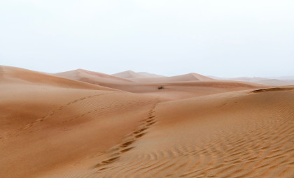
Researchers have developed the most precise map of sand dunes worldwide, exposing how wind, climate, and geological factors continuously mold these dynamic landscapes. This groundbreaking resource is poised to enhance our understanding of Mars, where dunes stand out as some of the few surface features offering vital environmental clues.
Led by scientists from Monash University, the study integrates satellite data with detailed topographic information to establish a global catalogue of dune formations. Featured in Nature Communications, the findings illuminate the reasons behind dune distribution and serve as a new benchmark for comparative studies of terrestrial and extraterrestrial terrains.
Though seemingly straightforward, sand dunes embody records of the natural forces that formed them. Wind regimes, sediment supply, vegetation cover, and underlying geology govern their shapes. Investigating these patterns enables scientists to decode past climates on Earth and analyze planets where in situ data is scarce.

Until now, the absence of a thorough global inventory limited our knowledge of dune occurrence and formation drivers. This comprehensive mapping effort by Dr. Andrew Gunn from Monash University's School of Earth, Atmosphere and Environment delivers a unified portrayal of dune systems worldwide.
Revealing the Planet’s Sand Dune Networks
The team analyzed extensive satellite imagery along with high-resolution elevation models to detect and classify dune fields. Researchers at Monash University discovered that dune development varies widely based on climatic conditions and surface characteristics.
In arid zones, dune shapes largely depend on the interplay between wind dynamics and sand availability. Converging wind flows can collect and propel sand particles, while proximity to sediment sources determines if dunes can grow.

In regions with higher moisture and vegetation, dune formation becomes more complex since plants stabilize sediments and reduce sand movement, necessitating stronger winds to activate dune migration.
The study demonstrates dune formation is influenced by multiple environmental elements working together rather than a single factor. This worldwide dune atlas enables cross-regional comparisons that deepen insights into the mechanisms shaping these landscapes.
Martian Surface Studies Benefit From Earth Dune Insights
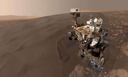
The research underlines how dune configurations can reveal planetary conditions beyond Earth. On Mars, dunes provide some of the rare visible markers indicating wind activity and surface composition.
Crescent-shaped barchan dunes are particularly informative; their form indicates prevailing wind directions and sediment characteristics. Scientists view these dunes as natural archives of the environments in which they formed.

These insights carry great weight for Martian studies, where direct environmental data is minimal. By comparing dunes on Mars to well-understood Earth counterparts, researchers can better interpret Red Planet surface processes. As Dr. Andrew Gunn states:
“Sand dunes can serve as natural archives of climate and geological history. Having a consistent, worldwide map allows us to better understand how wind-shaped landscapes evolve across our planet today, offering a clearer benchmark when analyzing similar features in the rock record or on planets like Mars.”
Innovative Tool For Monitoring Earth’s Changing Landscapes
This newly compiled dataset acts as a common foundation for geoscientists, climatologists, and planetary researchers, charting dunes on Earth and beyond. The Monash team highlights its potential to track shifts in wind regimes, desert expansion, and wind-driven erosion by providing a detailed dune location record.
The comprehensive global view of Earth’s dune systems offers a crucial reference for interpreting similar landforms on other planets. Understanding how terrestrial dunes respond to environmental variables informs analysis of formations light-years away.
“As global climate patterns shift, this map gives us a baseline to track how wind systems and drylands are changing in real time. Beyond looking backward at Earth’s history, it gives climate modelers a crucial tool to predict how desertification and wind-driven erosion might reshape communities in the decades ahead,” concluded Gunn.

- Categories:
- Science





0 comments
Sign in to Comment